
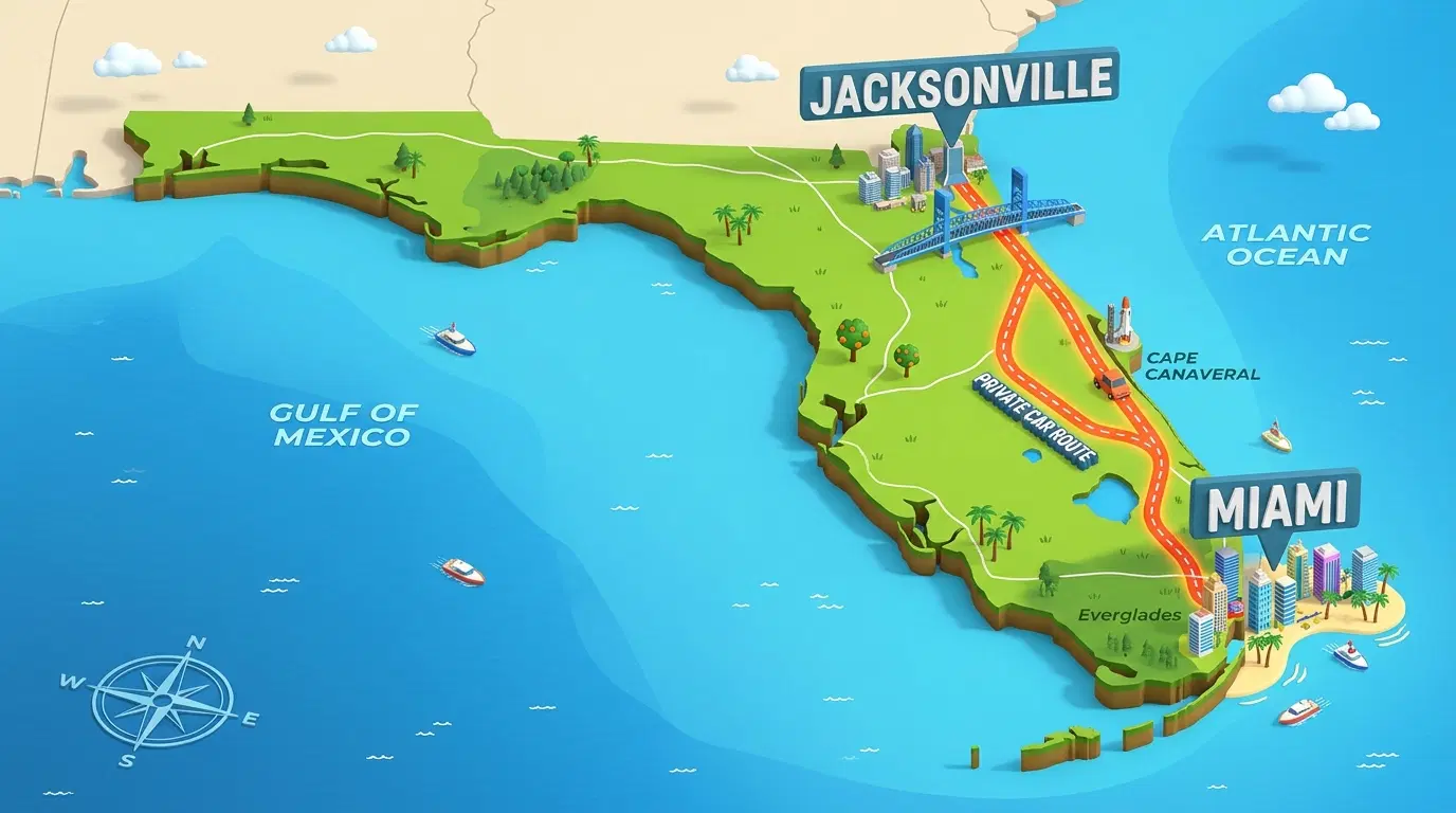
How far Jacksonville to Miami is depends on the pins you drop on the map, and the answer stays close to one number. Plan on about 345 miles by road, which takes five to six hours behind the wheel with no long breaks. Tampa to Miami runs roughly 280 miles. Sarasota to Miami sits near 230.
This guide covers the drive in detail, the faster ways to cross the state, and the Gulf Coast routes out of Tampa and Sarasota. You will also find the traps that turn a simple drive into a long day, and the cases where letting someone else drive makes more sense.
The Jacksonville to Miami Drive in Numbers
Distance and Drive Time on I-95
The distance from Jacksonville to Miami Florida comes out near 345 miles on most mapping tools. Sources quote anything between 329 and 350 miles, and the gap comes down to start and end points. A trip that leaves the Jacksonville airport area and ends in Coconut Grove covers more road than one that starts downtown and ends in Brickell.
The Jacksonville to Miami drive takes five to six hours when traffic cooperates. That number leaves out fuel stops, lunch, and the slow patch around Fort Lauderdale on a Friday afternoon. A realistic day with two breaks lands near six and a half hours.
I-95 carries almost all of the trip. The interstate runs 382 miles through Florida, the longest share of I-95 in any state, and your drive covers most of it. Expect long straight stretches, heavy truck traffic, and exits packed with gas stations, which makes fuel an easy problem to solve before you reach South Florida.
The Turnpike Option
Florida's Turnpike runs slightly inland of I-95 with fewer exits and less local traffic. It often holds a steadier pace than the interstate, and it charges tolls for the privilege. Many drivers stay on I-95 through Central Florida and switch to the Turnpike near Fort Pierce for the run toward Miami. Keep a transponder in the car, or ask your rental company how it bills tolls before you leave the lot.
Cities Worth Knowing Along the Way
I-95 passes Daytona Beach, where I-4 turns toward Orlando. It continues through Cocoa, Vero Beach, Fort Pierce, Port St. Lucie, West Palm Beach, Boca Raton, and Fort Lauderdale. Daytona Beach makes the natural spot for a first break. You can walk out onto a wide beach, grab a sandwich, and stretch your legs in twenty minutes. The second break fits best around Fort Pierce or Port St. Lucie, before the traffic thickens in Palm Beach County.
Quick Distance Guide
|
Route |
Approximate distance |
Typical drive time |
|
Jacksonville to Miami |
345 miles |
5 to 6 hours |
|
Jacksonville to Tampa |
200 miles |
3 to 3.5 hours |
|
Tampa to Miami |
280 miles |
A little over 4 hours |
|
Sarasota to Miami |
230 miles |
3.5 to 4.5 hours |
Use every figure for planning only. Weather, crashes, and holiday crowds move the real time up or down, and the exact miles shift with your pickup and drop-off points.
Other Ways to Cover the Distance
Flying
Direct flights between JAX and MIA take about an hour to an hour and fifteen minutes in the air. Add the drive to the airport, security, boarding, and the ride into town, and you spend a good half day on the move. Flying wins on tiring trips and loses on short ones with a rental car waiting at both ends.
Train and Bus
Brightline does not reach Jacksonville. It runs between Miami and Orlando with stops in Aventura, Fort Lauderdale, Boca Raton, and West Palm Beach. Amtrak serves both cities, though that ride takes much longer than driving. Intercity buses also cover the route and usually cost the least.
Landing in Miami
Plenty of travelers fly the Jacksonville leg and need ground transportation on arrival. Taxis and rideshares work. A private car service from Miami Airport works better when you carry heavy bags, travel with children, or need to reach a cruise terminal on a tight schedule. A driver tracks your flight, meets you after you land, and takes you to a hotel or a home anywhere in Miami-Dade or Broward.
What Slows the Drive Down
Distance gets the attention, while traffic and small choices decide how your day goes. Three spots cause most of the trouble.
The first sits around Jacksonville itself, where I-95 meets I-295 and I-10. Leave before the morning rush and you slip through. Leave at 8 a.m. and you start the day in a crawl.
The second is the Daytona Beach and Cocoa corridor on weekends, when beach traffic and long haul trucks share the same lanes.
The third is everything south of West Palm Beach. Palm Beach, Broward, and Miami-Dade counties run one continuous city, and any crash there ripples for miles. A single lane closure near Fort Lauderdale can add an hour to a trip that was running on time.
Fuel and charging deserve a plan too. Gas stations appear every few exits on I-95, and fast chargers have grown common near major interchanges. Electric car drivers should map their charging stops before leaving, and keep the battery well above empty when entering South Florida.
Rest stops help more than most drivers admit. A ten minute break every two hours keeps the last stretch calm. Kids get restless, and the driver loses focus, long before the odometer says it should happen.
Jacksonville to Tampa on the Gulf Side
Tampa sits about 200 miles out of Jacksonville, and the drive usually takes three to three and a half hours. Most routes follow I-75 for the long middle stretch. Traffic near Ocala and around Tampa can stretch the time on a Friday or before a holiday. Leave mid-morning when you can.
Many travelers make Tampa a first stop and continue to Miami the next day. That plan splits the long distance into two easy drives and gives you an evening on Tampa Bay. It also helps if you want to see the Gulf Coast before the Atlantic side.
Tampa to Miami Across Alligator Alley
The Tampa to Miami drive covers roughly 280 miles and takes a little over four hours without traffic. Holiday weekends and rush hours can push that toward six. The fastest road follows I-75 south to Naples and then turns east on the stretch called Alligator Alley.
Alligator Alley crosses close to 80 miles of the Everglades. The scenery is flat, green, and wide open, and the services are thin. Fill the tank before you enter, watch your speed, and expect a toll. Highway Patrol watches this road closely, and a breakdown in summer heat gets uncomfortable fast. Pack water and keep a phone charger within reach.
Brightline does not serve Tampa. Amtrak trains out of Tampa Union Station take about five hours and twenty minutes, only a little longer than driving. That makes the train a calm choice for travelers who dislike highway miles and do not mind a fixed schedule.
Splitting the Trip With an Orlando Stop
Orlando sits close to the midpoint if you picture Jacksonville and Miami at the two ends. The first leg runs a little over two hours by car. The second leg covers the rest of the distance and gives you a choice. You can keep driving, or you can ride Brightline between Orlando and Miami and let the train handle the Central Florida traffic.
Families with young children often prefer this split. Two shorter days beat one long day, and Orlando has no shortage of hotels, restaurants, and attractions for the middle night. If your group lands at Orlando International Airport on the way south, a Miami to Orlando transfer covers the second half with one driver, one pickup time, and no parking to hunt for at the other end.
Business travelers use the same idea in a smaller way. They drive to a morning meeting in Orlando and reach Miami by early evening, instead of squeezing the whole route into one long push.
The split also protects your schedule. A flight delay or a crash on I-95 costs less when the day has a built in stopping point. You can sleep in Orlando, check the morning traffic, and choose the road or the train with fresh information instead of guessing at dawn.
Sarasota to Miami
Sarasota sits about 230 miles away, and the drive takes between three and a half and four and a half hours depending on traffic. You follow I-75 south through Venice, Punta Gorda, and Fort Myers, then reach Naples, where the road turns east across Alligator Alley. Fort Myers makes a useful coffee stop, and Naples works well for lunch.
Sarasota Bradenton International Airport and MIA also have flights between them, which suits travelers who would rather skip the Everglades altogether. The flight is short, and the total time shrinks again once you count the ride to the terminal.
The route has its own rhythm. Sarasota and Venice give you easy, open miles on I-75 with steady traffic. Punta Gorda and Fort Myers bring more exits and more local drivers. Naples marks the last real town before the Everglades, which makes it the best place to fill the tank and buy water. After that, the road turns east, runs straight for close to 80 miles, and drops you into the western edge of the Miami area.
Winter changes the numbers. Seasonal residents fill the Gulf Coast highways between the cold months, and the same drive can take noticeably longer on a Friday afternoon. Summer brings afternoon storms that slow the Alley for a few minutes at a time. Heavy rain there looks dramatic and passes quickly. Slow down, keep your lights on, and wait out the worst of it.
Groups with two or three suitcases each tend to feel the length of this drive most. A rental car solves the space problem and then creates a return problem. Dropping it at a different city usually costs extra, and the line at the counter eats time you wanted for dinner.
Naples deserves a second look if your plans end there. Some travelers need only the southern half of the Gulf Coast route, and a Miami to Naples transfer fits that case well. A driver handles the Alley, your group relaxes, and you arrive with no rental car to return.
Timing, Weather, and Traffic Tips
Leaving before 7 a.m. or after 8 p.m. keeps you ahead of the worst Miami traffic. The last thirty miles are usually the hardest part of the whole drive. The move off I-95 onto the MacArthur Causeway or SR 836 can confuse first time visitors. Load your destination into a GPS before you reach the city.
Winter brings more drivers to both coasts. Hurricane season runs June 1 through November 30, and a storm in the Atlantic can turn I-95 into a slow line of evacuation traffic. Watch the forecast for two days before any late summer trip.
Sun glare matters more than people expect. A south facing windshield in the afternoon tires your eyes, and the driver's left arm heats up fast in an open window. Sunglasses and a light cover for your arm help more than another cup of coffee.
When a Private Transfer Beats Driving
A rental car makes sense for a week of road trips. It makes less sense for one long leg after a flight, a night of poor sleep, or a group with heavy bags. A private transfer replaces the driving, the parking, and the toll bills with one planned pickup.
We landed late, met our driver at arrivals, and the kids slept through the whole ride. After our last long drive, that felt close to a miracle.
Transpovia is a ground transportation marketplace. It helps travelers book airport transfers and private rides, and it does not run tours. That keeps the focus on getting you to your hotel, your home, or your next flight with fewer moving parts.
FAQs
How far from Jacksonville to Miami is the drive?
The drive covers about 345 miles on I-95. Depending on your exact start and end points, expect anywhere between 329 and 350 miles.
How long does the Jacksonville to Miami drive take?
Five to six hours without long stops. Add time for fuel, meals, and traffic around Fort Lauderdale and Miami, and a full travel day often reaches six and a half hours.
Is there a train between Jacksonville and Miami?
Amtrak connects the two cities, and the ride takes much longer than driving. Brightline does not serve Jacksonville. It runs between Miami and Orlando with stops in Aventura, Fort Lauderdale, Boca Raton, and West Palm Beach.
How far is Tampa to Miami, and which road do you take?
Tampa sits roughly 280 miles away, and the drive takes a little over four hours. Most drivers follow I-75 south and cross the Everglades on Alligator Alley.
How far is Sarasota to Miami?
About 230 miles. Plan on three and a half to four and a half hours, depending on traffic near Fort Myers, Naples, and Miami.
Can you drive Jacksonville to Miami in one day?
Yes. Leave early, share the driving when possible, and plan two short breaks. Arriving before dark makes the last stretch in Miami much easier.
Conclusion
The distance between Jacksonville and Miami is about 345 miles, and the trip fits into one long day. Tampa and Sarasota add Gulf Coast routes of 280 and 230 miles, and Alligator Alley shapes most of the planning for both. Leave early, fill the tank before the Everglades, and check traffic around West Palm Beach before the final push.
If you would rather skip the driving, Transpovia can set up an airport transfer or a private ride for the last leg. Booking ahead means a driver waits for you instead of the other way around.


